

HIKING

Cub Scouts commit to being physically strong and mentally awake. Our hiking program promotes these values. We support our community while in nature by leaving no trace and doing our best to leave the environment better than we found it. Our hikes are a great way to get to know our pack members and parents better, too.
Our Hiking Coordinator plans hikes monthly. Hikes will be posted on the website calendar at least 1 month in advance. Scouts and their families can also choose to complete the hike on their own.
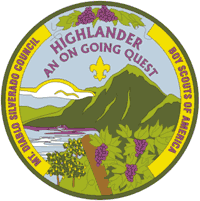
We work on the Highlander Program and the Trail Trekker series. For most hikes, scouts will earn a patch from one of these programs, but some hikes do not have a patch. However, all hikes count toward hiking achievement awards. We also complete urban hikes that align with service to the community, such as the Danville Parade, Scouting for Food, and Spring Clean at Twin Creeks. Scouts who complete 10 hikes earn a 3-in-1 flashlight. Scouts who complete 20 hikes earn a hiking staff. Scouts who complete 30 hikes earn a hydration pack.
Starting in 2021, scouts will be tracking their own hikes. Each scout will receive a tracking sheet from their den leader. Instructions on how to complete the form can be found HERE. Scouts can bring their completed forms to the Hiking Coordinator during group hikes or at Pack Meetings to receive their patches and milestone awards.

Coyote Hills
Coyote Hills Regional Park, Fremont
Little Yosemite
Sunol Regional Wilderness, Sunol
Black Diamond Mines
Black Diamond Mines Regional Park, Antioch
Hoot Owl
Sycamore Grove Regional Park, Livermore
Livermore Area Rec and Parks Dist. Info
Google Maps from San Ramon
Morgan Territory
Morgan Territory Regional Preserve, Livermore
Google Maps from San Ramon
Rodeo Lagoon
Golden Gate National Recreation Area, Marin
Golden Gate National Parks Conservancy
Google Maps from San Ramon
Sycamore Grove
Sycamore Grove Regional Park, Livermore
Livermore Area Rec and Parks Dist. Info
Google Maps from San Ramon
Wildcat Peak
Tilden Nature Study Area, Tilden Regional Park, Berkeley
Google Maps from San Ramon
Flag Hill
Sunol Regional Wilderness, Sunol
Trail Trekkers Info
East Bay Regional Parks Info
Google Maps from San Ramon
Huckleberry
Huckleberry Botanic Preserve, Oakland
Trail Trekkers Info
East Bay Regional Parks Info
Google Maps from San Ramon
Angel Island
Angel Island State Park, Ferry from Oakland or SF
Trail Trekkers Info
East Bay Regional Parks Info
Google Maps from San Ramon
Highlander Quest Hikes
Briones
Briones Regional Park, Lafayette/Martinez
Las Trampas
Las Trampas Regional Wilderness
Black Diamond Mines
Black Diamond Mines Regional Park, Antioch
Mt. Diablo
Mt. Diablo State Park
Fages Trail
El Cerrito
For 31 years, the Trails Challenge has been designed to get you outdoors, exploring on your own, with friends, or with loved ones. Easy, moderate and difficult routes are available, leading hikers to scenic destinations through a variety of EBRPD parklands. You can use any trail route to complete the Challenge, not just those listed in this year’s Guidebook, by exploring at least five trails or 26.2 miles.